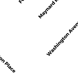
74 MAYNARD RD
Owner Information
BRUNSWICK RICHARD P
74 MAYNARD ROAD
NORTHAMPTON, MA 01060


Property Details
74 MAYNARD RD is classified as a Single Family Residential (1).
The primary structure on this property was built in 1900. There are 936ft2 of built area within this property. There is 2,262ft2 of residential/living space within this property. This property is listed as having 7 rooms.
74 MAYNARD RD is valued at $472,800. The land is valued at $277,900 and the structures are valued at $194,900. There is an additional valuation of $6,000 on this property.
74 MAYNARD RD was last sold on Sunday, November 1, 1992 for $180,000.
Assessment data from fiscal year 2020.
Flood Data
According to the FEMA National Flood Hazard Layer, this property does not appear to be in a flood zone. It may also be in an area not yet reviewed. Nonetheless, confirm this information prior to taking any action.
To view the flood hazards around this property, create a FEMA "Firmette" Map of the area around 74 MAYNARD RD.
Broadband Internet Providers
| Provider | Type | Bandwidth (mbps) | |
|---|---|---|---|
| Verizon New England Inc. | DSL | 15 | 1 |
| Viasat Inc | Satellite | 100 | 3 |
| Comcast | Cable | 1000 | 35 |
| T-Mobile | Fixed Wireless | 25 | 3 |
| GCI Communication Corp. | Satellite | 0 | 0 |
| HughesNet | Satellite | 25 | 3 |
| VSAT Systems, LLC. | Satellite | 2 | 1 |
Broadband service provider data from December 2020.
Adjacent Properties
- 55 WASHINGTON AVE
Single Family Residential owned by VOLKMANN STEPHEN E & ELIZABETH - 57 WASHINGTON AVE
Multiple Houses on one parcel owned by HULLEY DAVID A & ANNE B - 57 WASHINGTON AVE
Multiple Houses on one parcel owned by HULLEY DAVID A & ANNE B - 78 MAYNARD RD
Single Family Residential owned by RUDOLPH MARTA - 66 MAYNARD RD
Single Family Residential owned by MARTIN ROBERT &